

FarOut
Continental Divide Trail: North Montana Hiking Guide
Continental Divide Trail: North Montana Hiking Guide
Regular price
$14.99 USD
Regular price
Sale price
$14.99 USD
Unit price
per
Couldn't load pickup availability
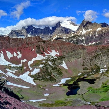
Official app of the Continental Divide Trail Coalition. This 568.3-mile portion of the Continental Divide National Scenic Trail goes through the northern part of Montana from CDT mile 2407.0 at Johnson Lake to CDT mile 2975.3 at the U.S.-Canada border. This guide includes 1050+ waypoints and these alternate routes and side trails: Anaconda Route, Butte connector, Spotted Bear Pass, Dawson Pass Alternate, Chief Mountain (alternate to international border), and 4-mile track in Canada to the town of Waterton, Alberta.
Talk about your brand
Share information about your brand with your customers. Describe a product, make announcements, or welcome customers to your store.